Clear South Wales Coal Tips
Below taken from Clear South Wales Coal Tips on Facebook
Hi all, I've been working on some observations of the Ynyshir Tips above Llanwonno Road in the Rhondda Fach Valley.
I've put the observations below in an email to the Rhondda Cynon Taf Local Authority a little earlier today. I'd suggest if anyone else has concerns about any tips in the area, they should do the same – please feel free to share the information here.
Dear [Coal Tips Team] & the Freedom of Information team thank you very much for the tip inspection reports for the collection of D3 high risk tips directly above my house.
Could I also please place a freedom of information request (if necessary) to find out
a. How far back in years your records go for inspections of the tips in Ynyshir (RH72).
b. the frequency (rough average) of the inspections?
With regard to the inspections provided. I'm very glad to see these inspections have been undertaken. However, I feel a page or so every 3+ months isn't very comprehensive and the reports appear to be a bit inconsistent.
I do hope you take these comments and observations seriously and investigate with urgency, before the next period of prolonged heavy rain.
1. It doesn’t appear that recommendations have been followed through:
a. Borehole investigations. It was recommended boreholes should be investigated in Feb 2020. Has this been undertaken? Since this report in February 2020, it has not been mentioned.
b. Path erosion on Llanwonno Road Bridleway was picked up in March 2019 along with the follow up action " Speak to Tony". Was the matter of culvert and path erosion brought to a satisfactory level of maintenance prior to the Feb 2020 problems?
2. No explanation has been provided as to why the category of risk changed from C to D between October 2019 and February 2020. This seems to me like a very large omission.
3. A few times it has been stated “couldn't see the tips because of vegetation” or ‘too slippery' to investigate. What follow up actions were taken?
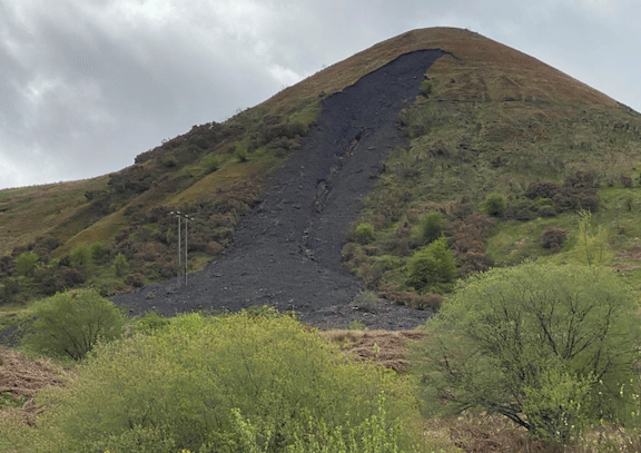
4. A ‘small tree’ has been mentioned in February 2020 as being uprooted – to me this looks like medium/large tree and more than one (SEE IMAGE). They still block the culvert 16 months later, is the landowner rectifying these issues?
5. On one hand it is stated at the end of many reports, the tips are "low risk" for detailed inspections yet they are classified as "high-risk" Category D(3). Doesn’t this seem like a conflicting statement?
II have provided my notes in pencil and pink highlighter on a scanned copy of the inspection reports.
Observations from the location and by looking at aerial photographs and historic/council maps. Also, observations on the hillside geology.
A. Culverts should be cleared not just inspected.
a. Trees have clearly been growing for a decade if not longer in the steep sided streams and scour channels.
b. If all open watercourses, culverts, streams and manholes are monitored on a 3 monthly bases, why do they show years if not decades of growth?
B. A pond at a distance from but draining through the southern point of the lower tip appears to have disappeared sometime after 2001 and perhaps before 2006 due to erosion or other. This needs to be re-instated.
a. This large pond is critical in regulating the flow of water into the stream/scour channel which emerges in a culvert opposite the Ynyshir Community School
b. The same scour channel/stream runs directly through the southern point of the lower tip on its way downhill to Ynyshir Community School.
c. This stream channel is overgrown with trees and vegetation. (SEE IMAGES)
C. Neighbours have informed me of ‘swamp like conditions’ behind the upper houses on Llanwonno Road. Much of this water emerges from the northern part of the lower tip, drains over and into the quarry and then crosses Llanwonno road between the top few houses.
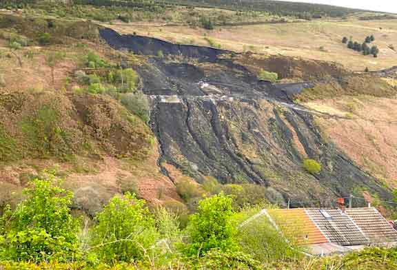
a. This same stream re-appears at the other side of the Heath Terrace roadway. During times of heavy rain, it appears the flow through the drainage pipe far exceeds the capacity of the pipe diameter. (SEE IMAGE)
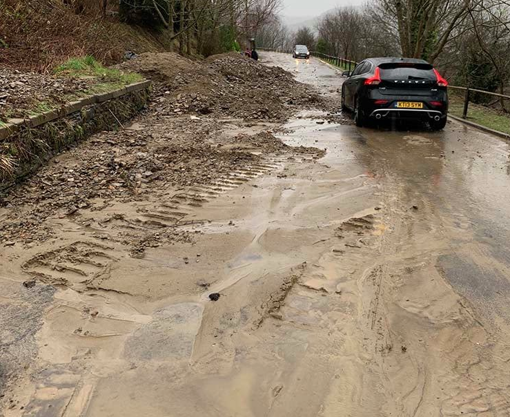
b. Directly in-between this culvert pipe and the culvert at the end of the Heath Terrace houses is where a minor landslide occurred over the road. (SEE IMAGE)
D. Neighbours on Llanwonno Road and Heath Terrace have told me they have repeatedly asked the landowner to address drainage issues. E.g. the aforementioned pond and ‘swamp like conditions’ behind the upper houses on Llanwonno Road.
E. A small void is visible on the lower tip above the quarry – has this been noted and assessed? (SEE IMAGE)
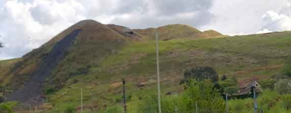
F. With regard to the upper tip on higher slopes of Ynyshir toward Llanwonno. The uppermost non-porous seam of coal, the Brithdir Rider is overlayed by fractured sandstone and it can be seen in the narrow step feature of the uppermost part of the hill.
a. A spring line may well develop where the junction of an overlying permeable and an underlying impermeable horizon outcrop along the hillside.
b. Thick beds of jointed weathered and hence permeable Pennant sandstone overlie the impermeable rock types associated with the Brithdir Rider and Brithdir seams. Both are potential spring lines, and the greatest activity would be expected along the crop of the Brithdir Rider because of the very wide nearly flat catchment area of the overlying sandstone. The easterly dip is very low and will not significantly aid drainage of water to the east away from the tip site.
c. The upper tips on the hillside of Ynyshir overlie the Brithdir Rider seam.
d. Below the same tips and further east toward Llanwonno is above an area of extensive mine workings in the region of 20 to 40ft of cumulative extraction. This extensive mine extraction is likely to cause further opening up of joints in the underlying strata, thereby increasing permeability. Particularly when a heavy mass of coal spoil is placed above. It can also be seen on the southernmost part of the lower tip, small streams disappear likely due to fracturing